
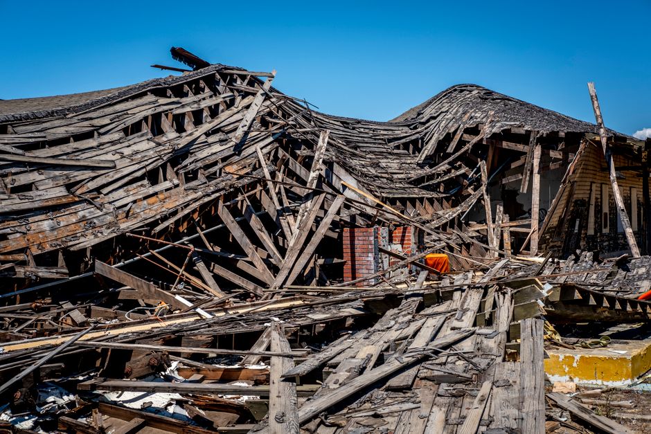
Natural disasters are events that overwhelm a community’s ability to cope, and they are caused by forces that operate on wildly different timescales. Earthquakes and volcanic eruptions come from processes deep inside the planet that have been running for millions of years. Hurricanes, floods, droughts, and wildfires come from the interaction of the atmosphere, oceans, and land surface. Prediction works differently for each type because the underlying physics is different. Some events can be forecast days ahead with reasonable confidence. Others cannot be predicted at all in any practical sense, and scientists are honest about that gap.
What Actually Counts as a Natural Disaster?
A natural hazard becomes a disaster when it intersects with human vulnerability. A magnitude 7.0 earthquake in an unpopulated desert is a geological event. The same earthquake under a dense city with weak building codes is a catastrophe.
This distinction matters because it shapes how scientists and emergency planners think about risk. The hazard itself — the storm, the fault rupture, the flood — is only one part of the equation. Exposure (how many people and structures are in harm’s way) and vulnerability (how well those structures and systems can withstand the event) determine whether a hazard becomes a disaster.
Common categories include:
- Geophysical: earthquakes, volcanic eruptions, tsunamis, landslides
- Hydrological: floods, flash floods, mudslides
- Meteorological: hurricanes, tornadoes, blizzards, heat waves
- Climatological: droughts, wildfires
- Biological: disease outbreaks, infestations
A heat wave that kills hundreds of elderly residents in a city without cooling centers is a disaster. The same temperatures in a well-adapted community may cause far fewer deaths. The physical event is identical. The outcome is not.
What Causes Earthquakes and Volcanic Eruptions?
Earthquakes happen when stress built up along faults — fractures in the Earth’s crust — suddenly releases as the rocks slip past each other. The crust is made of tectonic plates that move slowly, typically at rates comparable to how fast fingernails grow. Where plates lock together, stress accumulates over decades or centuries. When the rock finally breaks or slips, the stored energy radiates outward as seismic waves.
The magnitude scale measures the energy released at the source. It is logarithmic, meaning each whole number represents roughly 32 times more energy than the previous one. A magnitude 7.0 releases about 32 times the energy of a magnitude 6.0 and roughly 1,000 times the energy of a magnitude 5.0.
Volcanic eruptions occur when magma — molten rock — rises from deeper in the Earth and reaches the surface. This happens most often at plate boundaries: where plates pull apart, where one plate slides under another, or at hotspots where a plume of hot material rises from deep in the mantle independent of plate boundaries.
Not all volcanoes erupt the same way. The composition of the magma matters. Magma with more dissolved gas and higher silica content tends to be more viscous and produces more explosive eruptions. Magma that is runnier and lower in gas tends to flow more gently. This is why some volcanoes produce slow lava flows that people can sometimes outwalk, while others produce violent explosions with almost no warning.
What Causes Hurricanes, Tornadoes, and Other Severe Storms?
Hurricanes form over warm ocean water, generally where sea surface temperatures are at or above 26.5°C (about 80°F). Warm water evaporates, and the rising moist air creates low pressure at the surface. More air rushes in, picks up more moisture, and rises. The Coriolis effect — caused by the Earth’s rotation — gives the system its spin. Hurricanes rotate counterclockwise in the Northern Hemisphere and clockwise in the Southern Hemisphere.
The storm weakens when it moves over cooler water or land because it loses its energy source. Wind shear — winds at different altitudes blowing at different speeds or directions — can also tear a developing storm apart.
Tornadoes form from severe thunderstorms, specifically from rotating updrafts called mesocyclones. The exact process by which a mesocyclone produces a tornado is still an active area of research. Scientists understand the broad conditions that favor tornado formation, but predicting which specific storms will produce tornadoes remains difficult. Most supercell thunderstorms do not produce tornadoes.
Heat waves are caused by persistent high-pressure systems that trap hot air near the surface and suppress cloud formation, allowing more solar radiation to reach the ground. Urban areas can amplify heat because concrete and asphalt absorb and re-radiate heat — a phenomenon called the urban heat island effect.





What Causes Floods, Droughts, and Wildfires?
Floods occur when water enters a system faster than it can drain. The causes vary widely. Heavy rainfall over a short period can overwhelm drainage systems and rivers. Slow-moving storms can dump rain over the same area for hours or days. Snowmelt combined with spring rain can swell rivers. Dam failures and levee breaches can cause sudden, catastrophic flooding. Coastal flooding comes from storm surge — seawater pushed inland by hurricane winds — or from tsunamis generated by undersea earthquakes.
Droughts develop over months or years when precipitation falls below normal and evaporation exceeds the water supply. Drought is not simply a lack of rain. Temperature matters, because warmer air increases evaporation from soil and plants. A region can receive near-normal rainfall and still experience drought if high temperatures accelerate water loss.
Wildfires need three things: fuel, oxygen, and an ignition source. In many ecosystems, the buildup of dry vegetation over years creates the fuel load. Drought dries that fuel further. High winds and low humidity accelerate fire spread. Most wildfires are started by humans — from campfires, equipment sparks, power lines, or deliberate ignition. Lightning is the main natural cause.
Fire behavior depends heavily on weather, terrain, and fuel characteristics. Steep slopes cause fires to spread faster uphill because flames preheat the vegetation above them. Wind carries embers ahead of the fire front, sometimes starting spot fires hundreds of feet away.
How Are Natural Disasters Predicted?
Prediction methods differ by disaster type, and so does the reliability. This is one of the most misunderstood areas of earth science.
Hurricanes are the most predictable major natural hazard. Meteorologists use satellite data, aircraft reconnaissance, ocean buoys, and computer models to track developing storms. Forecasts of where a hurricane will go have improved substantially over recent decades. The average track error for a 48-hour forecast has been cut roughly in half since the 1990s. Intensity forecasting — how strong a storm will get — has improved more slowly and remains a significant challenge.
Tornadoes are predicted through watches and warnings. A tornado watch means conditions favor tornado formation in a broad area. A warning means a tornado has been detected by radar or reported by spotters. The average lead time for tornado warnings is around 10 to 15 minutes in the United States, though this varies. Scientists cannot predict specific tornadoes days in advance.
Floods are forecast using river gauges, rainfall data, soil moisture measurements, and hydrological models. Flash flood warnings can sometimes be issued with only minutes to a few hours of lead time. River flooding can be forecast days ahead in large river basins where water moves slowly downstream.
Earthquakes cannot be predicted in any reliable way. No method currently exists to determine the exact time, location, and magnitude of a future earthquake. Scientists can calculate the probability that a fault will produce an earthquake of a certain size within a given number of years, but this is a long-term statistical estimate, not a prediction. Research into earthquake precursors — changes in groundwater, electromagnetic signals, animal behavior — has not produced any method that works consistently. Some studies have suggested possible patterns, but none have been confirmed as reliable enough for operational use.
Volcanic eruptions are more predictable than earthquakes. Scientists monitor volcanoes using seismometers to detect small earthquakes caused by moving magma, GPS to measure ground deformation, gas sensors to measure sulfur dioxide emissions, and satellite imagery to detect thermal changes. These signals can provide days to weeks of warning for some volcanoes. Others give very little notice. The quality of monitoring varies widely around the world.
Tsunamis are detected by ocean sensors and seismic networks. Once an earthquake occurs, scientists can estimate whether it likely generated a tsunami and how long it will take to reach coastlines. This provides minutes to hours of warning depending on distance from the source. For nearby coastlines, the warning time may be too short for official alerts to help — the shaking itself is the warning.
Droughts are forecast on seasonal to multi-year timescales using climate models, ocean temperature patterns, and soil moisture data. These forecasts are probabilistic. They indicate whether conditions are more or less likely to be dry, not guarantee an outcome.
Wildfires are not predicted in the sense of knowing when and where one will start. But fire danger is assessed daily using temperature, humidity, wind, and fuel moisture data. The National Fire Danger Rating System in the United States classifies fire risk levels to help agencies allocate resources and issue public warnings.
Why Is Predicting Earthquakes So Much Harder Than Predicting Hurricanes?
The atmosphere and the solid Earth are fundamentally different systems. The atmosphere is observable in near real-time from satellites, and it changes fast enough that computer models can simulate its evolution over days. Hurricanes leave visible signatures — clouds, pressure drops, wind patterns — that can be tracked continuously.
Earthquake faults are buried miles underground. Scientists cannot directly see the stress state of a fault. They cannot measure when a specific patch of rock will reach its breaking point. The system is also nonlinear — small changes in stress can produce either a tiny slip or a massive rupture, and the physics does not allow precise forecasting of which outcome will occur.
This is not a failure of effort or technology. It reflects a genuine difference in the nature of the two systems. Weather is chaotic but observable. Faults are both chaotic and largely hidden.
What Makes a Community More Vulnerable to Natural Disasters?
Vulnerability is not just about geography. It is shaped by building codes, land-use planning, infrastructure quality, poverty, age distribution, and access to early warning systems.
Communities with strong building codes that are enforced tend to suffer fewer structural failures during earthquakes and hurricanes. Areas with good drainage infrastructure handle heavy rainfall better. Regions with robust early warning systems and public education campaigns reduce deaths from tornadoes, floods, and tsunamis.
Poverty increases vulnerability because people with fewer resources may live in higher-risk areas, have less ability to evacuate, and take longer to recover. Elderly populations are at higher risk during heat waves. Coastal development increases exposure to storm surge and sea-level rise.
Climate change is altering some hazard patterns. Research consistently shows that warmer ocean temperatures can fuel more intense hurricanes, though the total number of hurricanes may not increase. Heat waves are becoming more frequent and more severe. Wildfire seasons in some regions are growing longer. The relationship between climate change and specific events like individual tornadoes or earthquakes is different — earthquakes are not influenced by climate, while the link between climate and certain storm and fire patterns is well documented.
Frequently Asked Questions
Can earthquakes ever be predicted?
No reliable method currently exists to predict the exact time, location, and magnitude of an earthquake. Scientists can estimate the long-term probability of earthquakes along known faults, but this is not the same as a prediction.
How far in advance can a hurricane be predicted?
Hurricane track forecasts are generally useful up to about five to seven days ahead, though accuracy decreases with lead time. Intensity forecasts remain less reliable than track forecasts.
What is the difference between a tornado watch and a tornado warning?
A watch means conditions are favorable for tornadoes in a broad area over several hours. A warning means a tornado has been detected by radar or reported and people in the warned area should take shelter immediately.
Are natural disasters increasing because of climate change?
Some types are. Research consistently shows that heat waves are becoming more frequent and intense, and that warmer oceans can fuel stronger hurricanes. The picture is more complex for other hazards like earthquakes, which are not influenced by climate.